Two hikes in one week! Today, I am going to head to Boone Cliffs Trails to check out what has been described as a 'hidden gem'. This is a hike that I have been wanting to do for quite some time. I would like to get to Red River Gorge at least once by the end of the summer for a day hike, and based on the descriptions of Boone Cliffs, this may be the closest trail, in similarity, to the gorge in my immediate area. After reading about the location of the trail, I made a reconnasaince trip to the park a week prior, so that I was absolutely aware of the location. After seeing the THREE parking spaces at the trail head, I decided that I would arrive early for a morning hike.
I arrived at the trail head parking area at approximately 6:30am. There was another hiker lacing up and getting ready when I arrived. I am not quite sure what his pre-hike ritual entailed but, he was still getting ready when I started out onto the trail. I brought some extra gear with me on this solo hike today: my camelback with basic supplies and my GoPro POV camera. As I begin to hike more strenuous hikes and venture further from my immediate area, I plan to carry more with me and to document it all with my GoPro, so why not start today!?
“Hiking alone lets me have some time to myself.”
- Jamie Luner
A majority of the time, I prefer having someone with me during my hikes, but there are those days when you just need to be out there on your own. This happens to be one of those days. The 1.7 mile trail begins with a slight upward grade along a steady flowing creek. There are several natural springs in the area and based on the heat and lack of rain we have had recently, I can only assume that this creek is being fed by one of the springs. I kept my eye out for both redback and dusky salamanders, which both inhabit this particular valley, but I unfortunately did not see any. The hike quickly gains elevation from the start, as the trail takes you away from the creek and quickly uphill. The climb winds upward ultimately culminating at the top of the ridge. The the trail continues onto the right, with an overlook to the left. I went to the left to check out the cliff overlook and was impressed. It was not quite Red River Gorge, but it definitely had the same feel to it while standing at the top. Unlike the sandstone cliffs and tops of Red River Gorge, the rock at Boone Cliffs is considered conglomerate rock composed of gravel deposited as glacial outwash about 700,000 years ago. It definitely had a look and feel of compacted gravel, not the solid feel of granite or sandstone. Despite the dense growth of the forest, I was able to quickly realize the height of the cliff in relation to the valley floor. Unfortunately, the heavy vegetation limited the view of any other cliffs throughout the remainder of the hike.
"Climb up on some hill at sunrise. Everybody needs perspective once in a while, and you'll find it there."
- Robb Sagendorph
After spending some time on the cliff top, I followed the trail back to the loop. The trail was easy to navigate and follow, but definitely had some elevation changes. The best surprise of the morning was something that I had not planned for: a beautiful sunrise as I followed the eastern and northern portions of the counterclockwise loop. Not only was the natural beauty and sounds of the forest breathing new life into me, but I could feel the warm rays of the morning sun on my face rejuvenating me as well.
The remainder of the hike continued along as the morning sun continued to rise higher into the sky. After one last climb, I could sense a long slow meandering descent throughout the remainder of the hike. Throughout the hike there are side trails that branch off with what look to be posts that possibly held informational or directional signs. The signs are no longer there, and I got the better of my curiosity and stayed on the main trail. Those side explorations are much more suited for a day that includes a fellow hiker. The last portion of the trail brought me to the opposite side of the creek from where the hike started and followed a rapid descent to the main road, about 50 yards from the parking area and trail head.
Towards the end of the initial ascent
Coming upon the cliff overlook
The cliff overlook with the forested valley all around
The cliff overlook with the forested valley all around
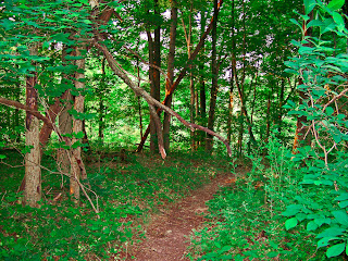
The Boone Cliffs Trail
One of the many ascents and elevation changees
Sunrise at Boone Cliffs Trail
Sunrise at Boone Cliffs Trail
Spring fed stream flowing towards Middle Creek


